-

by
Joe Lombardi
Weather
Relief from the extreme heat is coming thanks to a round of thunderstorms that will sweep through the region.After temperatures climb to around 90 degrees on another hazy, hot, and humid day on Friday, Aug. 27, scattered thunderstorms will begin to erupt in the mid to late afternoon.The chance for showers and storms will increase overnight and continue through the overnight into ...
-
by
Joe Lombardi
Weather
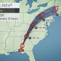
The remnants of Fred, which is now a Post-Tropical Cyclone, will bring locally heavy rainfall and localized flash flooding to the region, with isolated tornadoes possible.The time frame for the main brunt of storm activity in the area will be Wednesday night, Aug. 18 into around noontime Thursday, Aug. 19.For a look at the latest projected track and timing for Fred, see the first image ...
-

by
Joe Lombardi
Weather
Tropical Storm turned Depression Fred will affect the region with steady rain and some drenching downpours this week as it treks north.At 8 a.m. Tuesday, Aug. 17, the center of Fred was located near Columbus, Georgia. It has maximum sustained winds of 35 miles per hour with higher gusts.The time frame for the heavy rain and occasional downpours in this area is Wednesday night, Aug. 18 ...
-

by
Joe Lombardi
Weather
A new round of strong thunderstorms with gusty winds, heavy rain, and possible hail will sweep through the region.An isolated tornado is not out of the question, the National Weather Service said in a Hazardous Weather Outlook statement issued on Thursday, July 29.The time frame for storm activity is from mid-afternoon until late in the evening on Thursday."Repeated rounds of showers ...
-

by
Joe Lombardi
Weather
An approaching cold front will trigger a new round of showers and thunderstorms will be followed by a change in the weather pattern.Tuesday, July 27 will be warm with a hazy mix of sun and clouds. The high temperature will be in the upper 80s.Scattered storms will arrive late in the evening and continue into the overnight. A few storms may be severe with strong to damaging winds, the ...
-

by
Joe Lombardi
Weather
An approaching cold front will trigger a new round of showers and thunderstorms that will be followed by a big change in the weather pattern.Tuesday, July 20 will be hot, and humid, with spotty storms farther north and inland. (See the first image above.) The high temperature will be in the mid to upper 80s with hazy sunshine.Showers and thunderstorms will become widespread throughout ...
-

by
Zak Failla
Breaking News
Thousands in the area are still without power following the recent rash of storms that rolled through the region.Utility crews from Central Hudson have been working around the clock to restore power to more than 35,000 customers who have been impacted by thunderstorms that began toppling trees and felling power lines on Tuesday, July 6. “We continue to have our full complement of more ...
-

by
Joe Lombardi
Weather
An unsettled weather pattern that has brought rounds of scattered showers and thunderstorms will continue into the July 4th weekend.It won't be a complete washout at all, but the chance for spotty storms and showers will be a daily occurrence throughout the weekend, according to the National Weather Service. But there is good news at the tail-end of the long weekend as conditions will ...
-

by
Joe Lombardi
Weather
A slow-moving cold front will be accompanied by a round of strong to severe thunderstorms that could cause scattered power outages in the region, while also bringing about an end to the heatwave.The time frame for storm activity on Wednesday, June 30 is from the afternoon into the evening. Storms will be accompanied by damaging wind gusts of up to 50 miles per hour, frequent lightning, ...
-

by
Cecilia Levine
Weather
The second heat wave of Summer 2021 is here in the Northeast and expected to last throughout the week, forecasters say.The hottest days of the week will likely be on Monday and Tuesday, with a chance of afternoon thunderstorms all week.It could feel like it's between 100 and 105 degrees in North Jersey and Southeastern PA, while South Jersey will be between 90 and 95 degrees, ...
-

by
Joe Lombardi
Weather
The arrival of an unsettled weather pattern with isolated thunderstorms and showers will be accompanied by an increase in heat and humidity.Here's the five-day forecast:Saturday, June 26: Despite more clouds than sun, it will remain dry for most of the day into the evening. The high temperature will be in the low 80s, but high humidity will make it feel warmer. Keep an eye out for ...
-

by
Joe Lombardi
Weather
A Memorial Day weekend that was more like March than May was followed by a summerlike stretch with high temperatures hitting the 90s.The topsy-turvy weather pattern will take another turn with a return to cooler temperatures starting this weekend and continuing into next weekend, according to AccuWeather. (See the first image above.)Saturday, June 12 will be cloudy with a high ...


